Project
The Wealth of Our Lands (Boititap Korenyo)
-
Amount Funded
320,172 EUROProject Duration
28 Aug 2020 - 31 Mar 2025 -
-
Lead organisation
-
The Chepkitale Indigenous People Development Project (CIPDP) was founded in 2000 and registered in 2003 with the main goal of supporting the community pursuing land rights for the Ogiek Community. CIPDP principally works in the Mount Elgon region traversing Bungoma and Trans-Nzoia counties where the Ogiek community members live. It has also established working relationships with hunter-gatherer communities with whom they work with on land and resource rights.
The programmes are centred around land rights of the community and include:
(i) Community capacity strengthening on all aspects of land rights
(ii) Policy engagements
(iii) Legal support
(iv) Community conservation
(v) Support for sustainable livelihoods-
Organisation
The Chepkitale Indigenous People Development Project (CIPDP) was founded in 2000 and registered in 2003 with the main goal of supporting the community pursuing land rights for the Ogiek Community. CIPDP principally works in the Mount Elgon region traversing Bungoma and Trans-Nzoia counties where the Ogiek community members live. It has also established working relationships with hunter-gatherer communities with whom they work with on land and resource rights.
The programmes are centred around land rights of the community and include:
(i) Community capacity strengthening on all aspects of land rights
(ii) Policy engagements
(iii) Legal support
(iv) Community conservation
(v) Support for sustainable livelihoods -
Project
Design Phase (6 months)
The Wealth of Our Land is a collaboration between the Ogiek CIPDP in Mt. Elgon, Digital Democracy and Forest Peoples Programme to enable the Ogiek to combine their immense knowledge and skills in managing their customary land with new community-based GIS technologies. This helps them to collect and leverage data describing land and resource use to defend and advance their land rights.
The project objectives are;
1. Strengthen the Ogiek’s capacity to map and monitor their ancestral lands, across all groups in the community, to create and sustain comprehensive knowledge mapping.
2. Reduce the Ogiek’s marginalisation through increasing their ability to advocate for themselves in local and national platforms with government and other officials.
3. Secure greater land tenure for the Ogiek through legal mechanisms to reduce conflict with neighbours and increase internal fluency on territory issues.The design phase focuses on setting up a strong system for the Ogiek to gather and manage data on customary land use. It includes the customisation of new technology and comprehensive training to a team of Ogiek mappers within the CIPDP. The phase transitions into the implementation phase. Here, the mapping team continues to collect data however the focus shifts to using the data for internal decision making and external advocacy actions and ensuring long term sustainability. More training is provided to strengthen the Ogiek’s capacity to create products from the collected data, and creating map-based outputs.
Implementation Phase (18 months)
The project aims to promote just data-driven access to land and create more open participation and civic engagement on land issues. The project will empower the Ogiek Community to self – advocate and inform data collection processes, technological platform, research products and policy recommendations generated by the project. The disaggregated data, contextualised technological platform, evidence based research and policy recommendations will be utilised to influence and catalyse access and just land use by Ogiek Community. The project will also promote the creation of more political spaces, processes and participation accessible by the aforementioned rights holders.
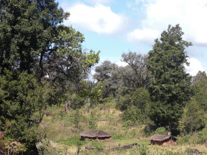
Lessons learnt and innovations from the design phase have informed the development of the Implementation Phase of the project. This project will be implemented in Ogiek lands in the Mt Elgon region in Kenya.
-
-
Design Phase (6 months)
The Wealth of Our Land is a collaboration between the Ogiek CIPDP in Mt. Elgon, Digital Democracy and Forest Peoples Programme to enable the Ogiek to combine their immense knowledge and skills in managing their customary land with new community-based GIS technologies. This helps them to collect and leverage data describing land and resource use to defend and advance their land rights.
The project objectives are;
1. Strengthen the Ogiek’s capacity to map and monitor their ancestral lands, across all groups in the community, to create and sustain comprehensive knowledge mapping.
2. Reduce the Ogiek’s marginalisation through increasing their ability to advocate for themselves in local and national platforms with government and other officials.
3. Secure greater land tenure for the Ogiek through legal mechanisms to reduce conflict with neighbours and increase internal fluency on territory issues.The design phase focuses on setting up a strong system for the Ogiek to gather and manage data on customary land use. It includes the customisation of new technology and comprehensive training to a team of Ogiek mappers within the CIPDP. The phase transitions into the implementation phase. Here, the mapping team continues to collect data however the focus shifts to using the data for internal decision making and external advocacy actions and ensuring long term sustainability. More training is provided to strengthen the Ogiek’s capacity to create products from the collected data, and creating map-based outputs.
Implementation Phase (18 months)
The project aims to promote just data-driven access to land and create more open participation and civic engagement on land issues. The project will empower the Ogiek Community to self – advocate and inform data collection processes, technological platform, research products and policy recommendations generated by the project. The disaggregated data, contextualised technological platform, evidence based research and policy recommendations will be utilised to influence and catalyse access and just land use by Ogiek Community. The project will also promote the creation of more political spaces, processes and participation accessible by the aforementioned rights holders.
Lessons learnt and innovations from the design phase have informed the development of the Implementation Phase of the project. This project will be implemented in Ogiek lands in the Mt Elgon region in Kenya.
-
Mapping for Justice: How the Ogiek Are Using Technology to Defend Their Land Rights
For generations, the Ogiek community of Mt. Elgon, Kenya has faced threats to their ancestral land, struggling against displacement, exclusion, and environmental destruction. The Chepkitale Indigenous Peoples Development Project (CIPDP), with support from Digital Democracy (Dd) and the Forest Peoples Programme (FPP), embarked on an innovative journey—using digital mapping technology to document, defend, and advocate for their land rights.Through the Innovate & Learn grant, the Ogiek mapped over 20,000 hectares of their customary land, collecting 10,000+ data points to demonstrate their historical connection to the land.
By training 45 young community mappers, including 20 women, the project empowered a new generation with GIS and mapping skills, bridging traditional land stewardship with modern digital tools. This collaboration between elders and youth ensured that centuries of Indigenous knowledge were preserved and validated through a Spatial Plan Committee, which played a key role in analyzing the collected data. The maps produced became powerful advocacy tools, presented to Kenya’s National Land Commission (NLC) as part of the Ogiek’s land tenure claims. In response, the Commission visited the Ogiek community, marking a significant step toward recognition of their land rights.
Beyond mapping, the project strengthened community mobilization and advocacy, leading to the establishment of a Community Resource Center, a safe space for meetings, advocacy efforts, and knowledge exchange. The project also reached a regional audience, hosting the East Africa Women-Led Assemblies, where 200+ Indigenous women from across the region gathered to discuss land governance, leadership, and rights advocacy. This learning exchange has already inspired five additional Indigenous communities to begin their own land mapping processes.
Lessons Learned: Strengthening Land Rights Through Innovation and Collaboration
One of the most profound lessons from this project is the power of digital tools in strengthening Indigenous advocacy. Mapping is not just about collecting geographic data—it is about telling a story, and in this case, a story of heritage, identity, and resilience. By combining GIS technology with traditional land knowledge, the Ogiek community has created irrefutable evidence of their presence and use of the land, shifting power dynamics in land governance discussions.
Another key learning was the importance of intergenerational collaboration. Elders, who hold centuries of knowledge about biodiversity, land use, and cultural practices, worked side by side with youth mappers trained in digital skills. This exchange of wisdom and technology ensured that the mapping process was culturally grounded and community-driven.
Additionally, building strong alliances and networks has proven essential. Engaging with the National Land Commission, Kenya Wildlife Service, regional Indigenous groups, and international advocacy organizations helped amplify the Ogiek’s struggle on a larger scale. Linking and Learning with other Voice grantees and Indigenous communities across East Africa further strengthened solidarity and strategy-sharing.
Finally, the project reinforced that land rights are a gender issue. The active participation of women in land governance discussions challenged traditional gender norms and expanded the conversation on land ownership and resource management. Women’s voices were amplified, and they played a crucial role in shaping the advocacy agenda.
Looking Ahead: A Future of Recognition and Resilience
The success of this project has set the foundation for continued community-led land advocacy. The Ogiek now aim to establish a permanent Community Mapping Hub, where other Indigenous communities can learn, train, and replicate the mapping process in their territories. Plans are also underway to expand the Community Resource Center into a Cultural Museum, preserving historical maps, artifacts, and oral histories for future generations.
As the Ogiek community continues its fight for formal land tenure recognition, this project has shown that when communities document their own histories, they claim their rightful place in decision-making spaces. Through innovation, collaboration, and unwavering resilience, the Ogiek are proving that their land is not just territory—it is identity, tradition, and life itself.
-
News